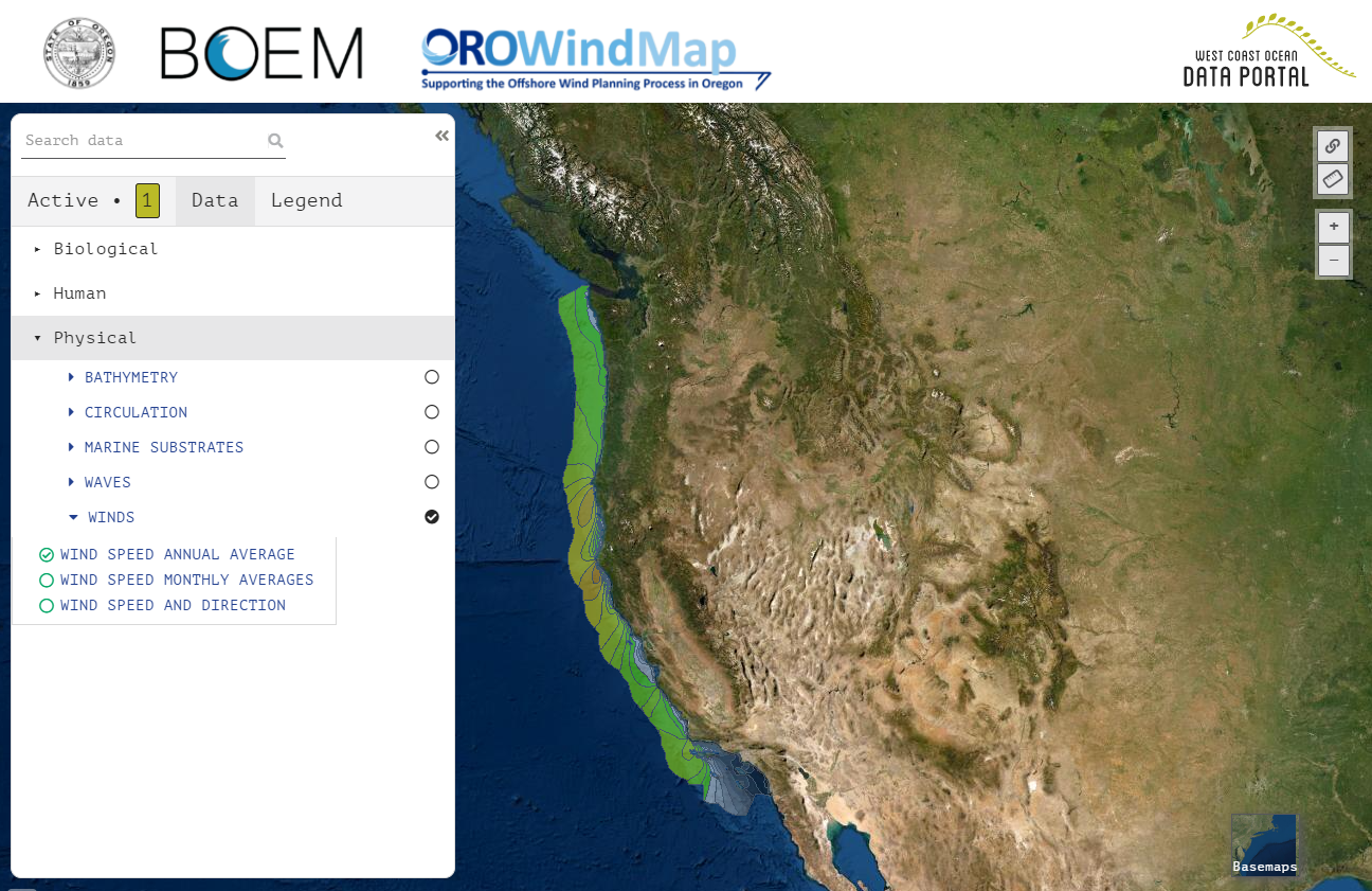
OROWindMap
The State of Oregon and the Bureau of Ocean Energy Management have developed a new tool to support the Intergovernmental Task Force on Marine Renewable Energy, OROWindMap. The OROWindMap Tool provides an extensive catalog of information that are provided by the authoritative sources around the region, or published by the Department of Land Conservation and Development in their role of support for the Task Force.
The Oregon Department of Land Conservation and Development maintains this website. Please contact the Marine Affairs Coordinator below for more information or with comments.
Andy Lanier
Marine Affairs Coordinator
635 Capitol St. NE, Suite 150
Salem, OR 97301-2540
Andy.Lanier@dlcd.oregon.gov
Upcoming Meetings
No events found